**Geography and Demographics:**
– Maywood covers 1.29 square miles with an elevation of 89 feet.
– It shares borders with Hackensack, Lodi, Paramus, and Rochelle Park.
– The 2020 population was 10,080, with a 5.5% increase from 2010.
– Median household income in 2010 was $82,792.
– The 2010 census counted 9,555 people with a diverse racial background.
– In 2000, the population was 9,523 with a median household income of $62,113.
**Economy and Business:**
– Maywood’s central business district houses local restaurants and shops.
– Coca-Cola sources coca leaf extract from a Stepan Company plant in Maywood.
– Myron Corp and Fake Chapter Records are local businesses.
– Maywood has a commercial area in Bergen Town Center.
– Economic characteristics from the 2006-2010 American Community Survey are available.
**Government and Politics:**
– Maywood follows the borough form of New Jersey municipal government.
– Maywood is part of the 5th and 9th Congressional Districts.
– Elections for all positions are held at-large on a partisan basis.
– Representatives include Josh Gottheimer and Bill Pascrell.
– Voter turnout in presidential elections has been consistently high in Maywood.
**Education and Historic Sites:**
– Maywood Public Schools cater to pre-kindergarten through eighth grade students.
– Memorial School received the National Blue Ribbon School Award of Excellence.
– Maywood Train Station and other historic sites are listed on the National Register of Historic Places.
– Maywood Avenue School students historically attended Hackensack High School.
– The educational system in Maywood encourages student involvement in extracurricular activities.
**Transportation, Emergency Services, and Religion:**
– Maywood has 24.91 miles of roadways, with Route 17 being significant.
– NJ Transit bus routes serve Port Authority and George Washington Bridge Terminals.
– Maywood Police Department has 22 sworn officers.
– Emergency medical services are provided by Hackensack University Medical Center.
– Religious institutions in Maywood include Our Lady Queen of Peace Roman Catholic Church and First Presbyterian Church.
Maywood is a borough in Bergen County, in the U.S. state of New Jersey. As of the 2020 United States census, the borough's population was 10,080, an increase of 525 (+5.5%) from the 2010 census count of 9,555, which in turn reflected an increase of 32 (+0.3%) from the 9,523 counted in the 2000 census.
Maywood, New Jersey | |
|---|---|
 NYSW train at the Maywood Station Museum | |
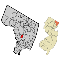
 Location of Maywood in Bergen County highlighted in red (left). Inset map: Location of Bergen County in New Jersey highlighted in orange (right). | |
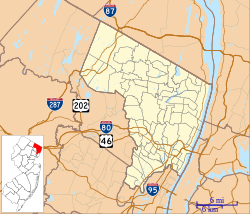
 Census Bureau map of Maywood, New Jersey | |
| Coordinates: 40°54′10″N 74°03′48″W / 40.902885°N 74.063457°W | |
| Country | |
| State | |
| County | Bergen |
| Incorporated | June 29, 1894 |
| Government | |
| • Type | Borough |
| • Body | Borough Council |
| • Mayor | Richard Bolan (D, term ends December 31, 2023) |
| • Administrator | Adrian Febre |
| • Municipal clerk | Barbara L. Dispoto |
| Area | |
| • Total | 1.29 sq mi (3.34 km2) |
| • Land | 1.29 sq mi (3.33 km2) |
| • Water | 0.00 sq mi (0.01 km2) 0.16% |
| • Rank | 471st of 565 in state 59th of 70 in county |
| Elevation | 89 ft (27 m) |
| Population (2020) | |
| • Total | 10,080 |
| • Estimate (2022) | 10,000 |
| • Rank | 242nd of 565 in state 38th of 70 in county |
| • Density | 7,832.2/sq mi (3,024.0/km2) |
| • Rank | 54th of 565 in state 16th of 70 in county |
| Time zone | UTC−05:00 (Eastern (EST)) |
| • Summer (DST) | UTC−04:00 (Eastern (EDT)) |
| ZIP Code | 07607 |
| Area code(s) | 201 |
| FIPS code | 3400344880 |
| GNIS feature ID | 0885294 |
| Website | www |
Maywood was incorporated as a borough on June 29, 1894, from portions of Midland Township, based on the results of a referendum held that day. The borough was formed during the "Boroughitis" phenomenon then sweeping through Bergen County, in which 26 boroughs were formed in the county in 1894 alone. The borough's name came from the name of a station established in the area by the New Jersey Midland Railroad.


